Resilient Rivers Initiative
The Resilient Rivers Initiative 2015-2025 was launched in December 2014 with the aim of improving the health of South East Queensland's catchments, rivers and Moreton Bay through collaborative leadership in catchment management involving state and local government agencies, water utilities, regional partners and the community.
The vision of the strategy is that by 2045, the catchments of South East Queensland (SEQ) will support a resilient, productive, liveable and growing region.
The vision has the following supporting goals:
- To promote partnerships with strong leadership to deliver a coordinated approach to catchment management in SEQ
- To keep soil on our land and out of our waterways
- To help protect our region’s water security so it can support the current and future population of SEQ
- To improve the climate resilience of our region.
The progressive development of Catchment Action Plans across the region provides an overview of the risks to the assets and values of each catchment, whilst providing a framework to guide investment for on-ground works. The Catchment Action Plans have been developed with input from the catchment stakeholders and provide a prioritised list of actions to help deliver the goals of the Resilient Rivers Initiative.
Logan-Albert Catchment Action Plan 2017-2020
The Logan-Albert Catchment Action Plan 2017-2020 focuses the initiative on the Logan-Albert catchment and addresses the risk to the lower catchment, Logan estuary and Moreton Bay from very high sediment movement due to past and present land uses within the catchment.
The action plan identifies on-ground and policy actions to achieve the initiative's vision. They incorporate the best available knowledge of risks to the Logan-Albert catchment and are a framework for informing investment and prioritising on-ground works within the catchment.
Scenic Rim Regional Council and Logan City Council are currently working towards the delivery of several actions from the Logan-Albert Catchment Action Plan. These actions include:
- Working with landholders to protect and maintain riparian areas of high value and enhance those with a high risk in priority investment areas
- Improving capacity to implement and ensure compliance of existing requirements for erosion and sediment control on construction sites by establishing a targeted 10 year program for the high growth areas
- Investigating options to minimise the impacts of the disposal of spent chicken farm litter on horticultural and turf farms within the Rathdowney, Kooralbyn and Cedar Grove Water Treatment Plants offtake zones
Improving landholder management of the riparian zone by clarifying the rights and responsibilities of landholders.
Mid-Logan Focal Reach - Riparian Landholder Engagement Project
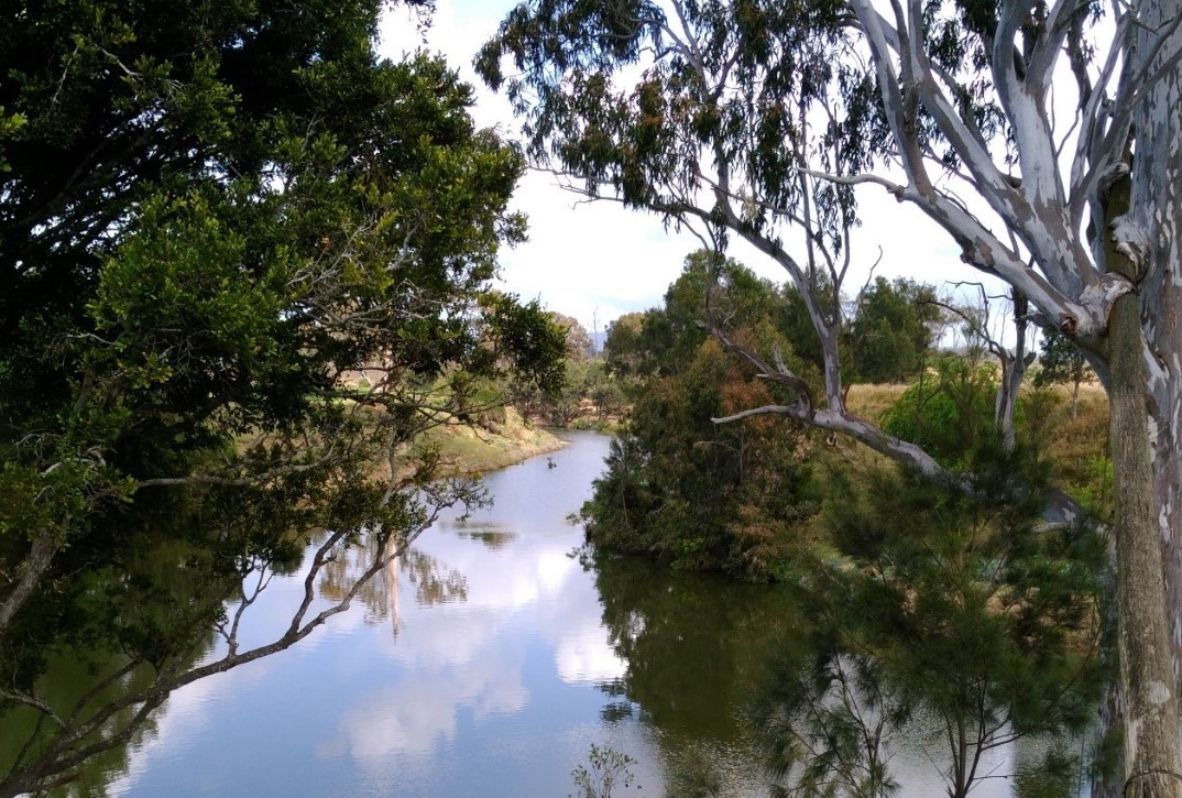
Within the Logan-Albert catchment, the Mid-Logan has undergone significant development and suffers from severe stream bank and in-channel erosion increasing sediment and nutrient load in the waterway and moving downstream.
Scenic Rim Regional Council in collaboration with Logan City Council is delivering riparian projects in the Mid-Logan with a strong focus on landholder and stakeholder engagement with the following objectives:
Developing and managing relationships with landholders and other stakeholders to identify and develop opportunities for effective on-ground works and engagement programs associated with riverbank restoration
Implementing on-ground river bank, tributary and gully restoration works with a focus on weed management, riparian planting, erosion stabilisation, stock fencing, off-stream watering and the creation of refuge gullies to minimise or prevent erosion and sedimentation, support agricultural productivity and improve water quality.
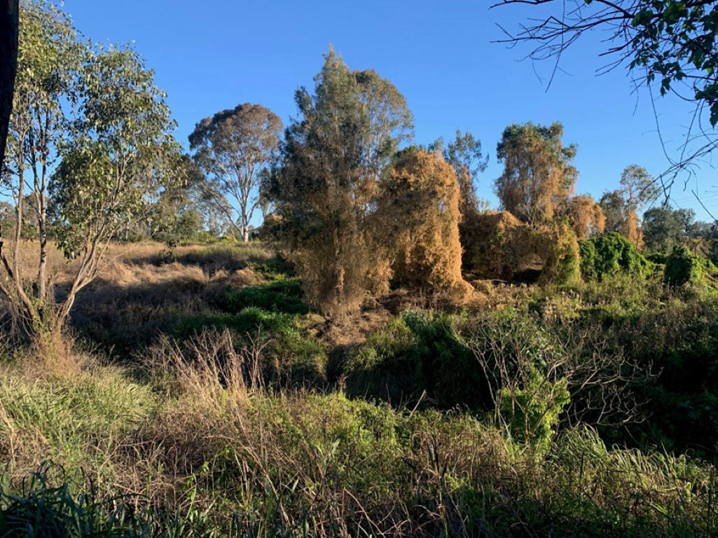
Weed management
Weed management focuses on the treatment of environmental weeds which are a threat to native species. Native species provide habitat and protect the riverbanks from erosion. Targeting vine weeds like cat's claw creeper (Dolichandra unguis-cati) which can totally smother native trees has been a priority of on-ground action.
Revegetation
Scenic Rim Regional Council and Logan City Council have collaborated with landholders to plant thousands of local native species along the riverbanks of the Mid-Logan. Species are chosen to complement existing vegetation and create plant communities like what historically existed in the area based on regional ecosystem mapping.
Plant species include trees like Eucalyptus tereticornis, shrubs like Melaleuca viminalis and ground covers like Lomandra hystrix. All these species contribute to streambank stability.
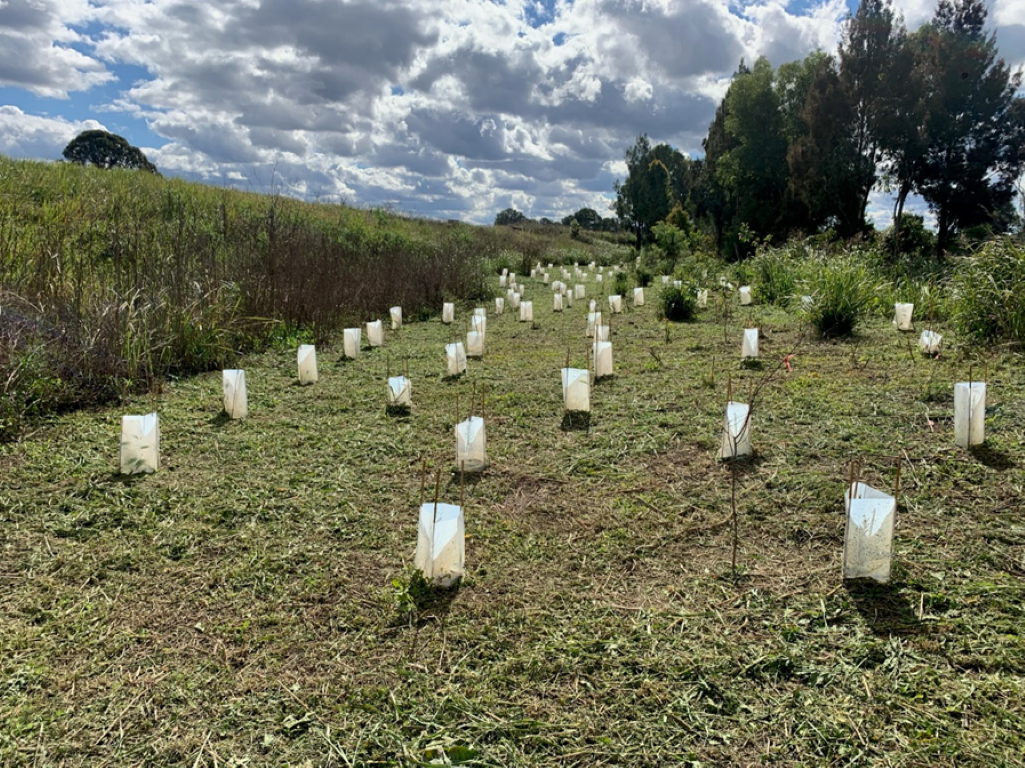
In time, revegetation will reduce streambank erosion and the amount of sediment entering the waterway which will improve water quality.
Gully stabilisation
The stabilisation of eroding gullies initiating on steep riverbanks sometimes requires more than weed management and revegetation. In the priority reach, the Resilient Rivers Initiative has funded gully restoration projects using a combination of gully bank battering, rock chutes and a stilling pond to slow down water and reduce sediment flow into the Logan River. New projects are under investigation.

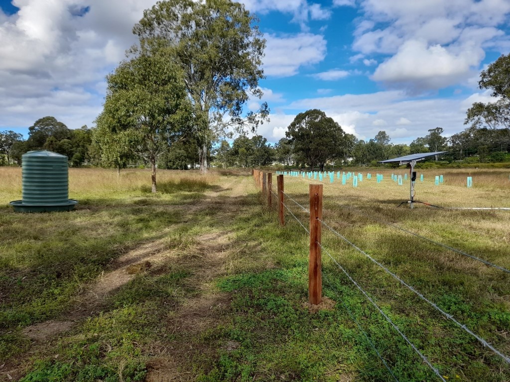
Stock fencing and off-stream watering
Stock fencing and off-stream watering points contribute to riverbank management and enable natural restoration and regeneration. Resting riverbanks from grazing and creating refuge gullies assists vegetation to recover and improves bank stability and soil retention.
Turf Production Environmental Management Plan Template
Turf production is a dominant land use in the Mid-Logan as well as other areas of the Logan-Albert catchment. Many turf farms are in close proximity or adjacent to the sensitive riverine environment of the Logan or Albert River. A Resilient Rivers Turf Production Environmental Management Plan Template(PDF, 2MB) has been developed to assist turf producers with the preparation or improvement of an Environmental Management Plan (EMP) for their farm to ensure that environmental values relevant to each turf farm are identified, adequately protected and enhanced.
The template provides information about environmental best practice relevant to the turf industry with suggested headings and sub-headings for an EMP as well as key aspects to address under each heading with text boxes providing instructions and links to databases and relevant literature. While not a regulatory requirement, the development of an EMP is an opportunity to better manage environmental aspects of turf production and for operations to contribute towards improved land management within the Logan-Albert Catchment.
Bremer River Catchment Action Plan 2017-2020
Bremer River Catchment Action Plan (CAP)
The primary focus of the Bremer River Catchment Action Plan (CAP) is to address the very high risk of flooding, erosion, sediment and pollutant movement through the catchment and its impact on downstream creeks, the Brisbane River and Moreton Bay.
The Bremer River catchment is approximately 2032 km2 and flows through the Scenic Rim Regional Council and Ipswich City Council local government areas. The Catchment Action Plan has been endorsed by both councils and collaboration has begun to deliver on-ground works within key focus areas of the catchment.
Further information